


A resource for reliable information about significant people, places, events, and things in Minnesota history.
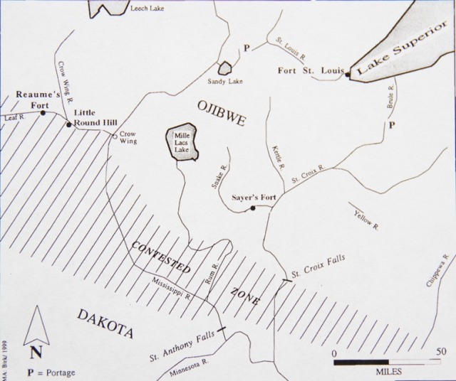
Sketch showing the approximate boundaries of the contested zone between the Ojibwe and the Dakota in the late 1700s. Adapted from Douglas A. Birk, “A Preliminary Archaeological Study of the Little Round Hill Site, Old Wadena Park, Wadena County, Minnesota,” 1991.
Made possible by the Arts and Cultural Heritage Fund through the vote of Minnesotans on November 4, 2008. Administered by the Minnesota Historical Society.
Minnesota Historical Society • 345 W. Kellogg Blvd., St. Paul, MN 55102-1906 (Map) • 651-259-3000 © MNHS.
Send questions or comments to mnopedia![]() mnhs [dot] org. View our Privacy Policy.
mnhs [dot] org. View our Privacy Policy.