- Membership |
- Shop |
- Calendar |
- Donate
A resource for reliable information about significant people, places, events, and things in Minnesota history.

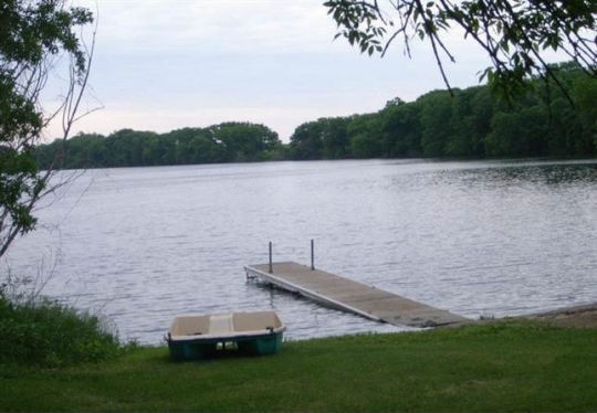
Talcot Lake, in Cottonwood County.
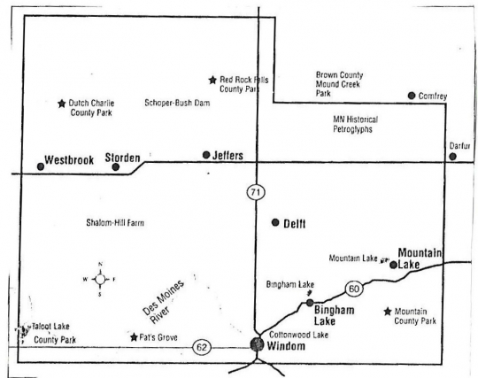
Talcot Lake County Park, a forty-acre piece of land situated in Cottonwood County on Highway 62 between Windom and Fulda, offers visitors a place to appreciate the wildlife and natural beauty of Southbrook, the county’s southwestern-most township.
In the 1700s and early 1800s, the area around Kandi Kastakapi Mde (Lake Where They Hunt Buffalo Fish) was a summer village and burial site of the Sisseton Dakota. Rich with mink and muskrats, prairie chickens, pheasants, waterfowl, beaver, and deer as well as fish, the area was a valuable source of food as well as pelts for clothing and trade.
When white fur traders first came to the area around 1835, they established a post for the American Fur Company at the headwaters of the Des Moines River. In the early 1840s, the French mapmaker Joseph Nicollet gave the name Lake Talcot to Kandi Kastakapi Mde in recognition of Andrew Talcott (1797‒1883). Talcot, a civil engineer, was surveying the northeastern border of the United States at the time. (The reason for the change in spelling is unrecorded but may be related to the transition of the surname from English into French.)
After the 1851 Treaty of Traverse des Sioux forced the Dakota around Kandi Kastakapi Mde to move to a reservation, settler-colonists claimed the area for themselves. The lakeshore was the home of the first settler-colonists to live in the community that became Southbrook Township (named for Little Brook, which flowed out of the lake). A fur trapper with the surname Talke built a log cabin for himself and his daughter on the lake in the 1850s or early 1860s, and two other families followed in 1867.
The United States Fish and Wildlife Service built Talcot Dam on the site in 1936 before turning it over to the State Department in 1948, at which point it became state-managed land. The Dundee Rod and Gun Club began using it as a hunting and fishing preserve in 1957 and named it Talcot Lake County Park.
In December 1974, Cottonwood County Park purchased thirty acres adjacent to the state-owned property. A $40,000 grant from the Land and Water Conservation Fund (LAWCON) financed access roads, picnic facilities, comfort stations, and a campground. The purchase supported the goals and objectives of the Cottonwood County Park System and eliminated the possibility of unsightly land use and exploitation.
A lease on the state-owned portion of land was drawn up to enable Cottonwood County Parks to carry out recreational and land use functions. It was signed on January 29, 1976. In May of that year, the land was leased to the county for development and maintenance guided by the Minnesota Department of Natural Resources (DNR).
In 1985, Cottonwood County opened Talcot Lake Park to the public for daily recreational use and as an access point for Talcot Lake. It continued to serve as a camping and swimming area. Later that year, LAWCON provided a grant for landscaping, camping pads, road improvements, and the development of a dump station and well-water system.
In 2019, Talcot Lake County Park’s amenities include sixty-five camping sites with water and electricity; areas for campers to set up tents; picnic tables and grills; bathrooms with showers; and an unsupervised swimming area. The site is open from May 1‒October 31, with a shorter bathhouse season.

The Centennial History of Cottonwood County, Minnesota. [Windom?: MN]: N.p., 1970.
Durand, Paul. Where the Waters Gather and the Rivers Meet: An Atlas of the Eastern Sioux. N.p.: Paul C. Durand, 1994.
Hudak, G. J. “Archaeological Survey of the Talcott Lake County Park, Cottonwood County, MN.” Unpublished report created at the Science Museum of Minnesota, 1977. State Historic Preservation Office, St. Paul.
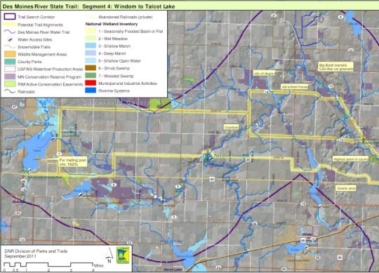
Minnesota Department of Natural Resources. Division of Parks and Trails. Des Moines River Valley State Trail Master Plan. Draft, November 16, 2011.
https://www.scribd.com/document/72911381/Des-Moines-River-Valley-State-Trail-Master-Plan-Draft
Minnesota Division of Fish and Wildlife. Talcot Lake Wildlife Management Area. St. Paul: Minnesota Department of Natural Resources, Division of Fish and Wildlife, [1978?].
Upham, Warren. Minnesota Place Names: A Geographical Encyclopedia. Third edition. St. Paul: Minnesota Historical Society, 2001.
 |
 |
 |
In 1976, Cottonwood County signs a lease that enables it to carry out recreational and land-use functions at Talcot Lake.
Sisseton Dakota people establish a summer village at Kandi Kastakapi Mde (Lake Where They Hunt the Buffalo Fish).
White fur traders and surveyors arrive at Kandi Kastakapi Mde. Following the lead of explorer Jean Nicollet, they begin to refer to it as Lake Talcot after regional surveyor Andrew Talcott. The reason for the change of spelling is unknown.
The terms of the Treaty of Traverse des Sioux require the Dakota living around the lake to move to a reservation along the Minnesota River.
The Minnesota Department of Conservation(a predecessor of the Minnesota Department of Natural Resources) buys 1000 acres of marsh and cropland around Lake Talcot.
The WPA builds Talcot Dam on the Des Moines River outlet of Talcot Lake. Eighty acres were transferred to the federal government by the state for this project
A US Biological Survey establishes the Talcot Lake Migratory Bird Refuge on the 1000 acres bought by the state in 1935.
Minnesota deeds 725 of the original 1000 acres to the federal government and grants it conditional use of another 160 of the acres.
The federal government turns over management of Talcot Dam to Minnesota, while still maintaining ownership.
Minnesota exchanges ownership of portions of the Rice and Tamarac National Wildlife Refuges for ownership of the Talcot Dam and the surrounding area. The Dundee Rod and Gun Club creates Talcot Lake County Park and begins to use it as a hunting preserve.
Cottonwood County Parks buys thirty acres of land adjacent to the state-owned property.
Talcot Lake County Park is leased to Cottonwood County for development and maintenance under the Minnesota Department of Natural Resources.
The state-owned land is separated from the thirty acres owned by Cottonwood County.
Cottonwood County and the Minnesota Department of Natural Resources collaborate to restore the southwestern perimeter of Talcot Lake.
Made possible by the Arts and Cultural Heritage Fund through the vote of Minnesotans on November 4, 2008. Administered by the Minnesota Historical Society.
Minnesota Historical Society • 345 W. Kellogg Blvd., St. Paul, MN 55102-1906 (Map) • 651-259-3000 © MNHS.
Send questions or comments to mnopedia![]() mnhs [dot] org. View our Privacy Policy.
mnhs [dot] org. View our Privacy Policy.