- Membership |
- Shop |
- Calendar |
- Donate
A resource for reliable information about significant people, places, events, and things in Minnesota history.
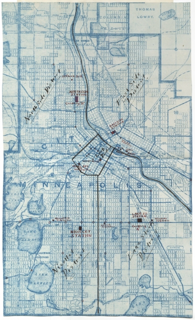
War map of Minneapolis drawn during the Twin Cities Streetcar strike, 1917. The map was likely drawn by Minnesota Home Guard and Minneapolis police commanders. Original map is in the Edward Karow Scrapbooks, 1917–1925, Manuscript Collection, Minnesota Historical Society, St. Paul.
Made possible by the Arts and Cultural Heritage Fund through the vote of Minnesotans on November 4, 2008. Administered by the Minnesota Historical Society.
Minnesota Historical Society • 345 W. Kellogg Blvd., St. Paul, MN 55102-1906 (Map) • 651-259-3000 © MNHS.
Send questions or comments to mnopedia![]() mnhs [dot] org. View our Privacy Policy.
mnhs [dot] org. View our Privacy Policy.